Paleogene Mounds, Stord Basin The Hugin East Formation aquifer
Paleogene mounds
This prospect is based on seismic 2D interpretation on a mounded reflector in the Paleocene/Eocene sequence in the central part of the Stord Basin. The reflection pattern has been interpreted as a possible deep marine fan system which could have a high content of reservoir sand. There are few wells in the area, and sand have not been proved by drilling in this particular interval. If sand is present, the mapped structure can be regarded as a structural/stratigraphical trap with good seals. The aquifer outside the mapped structure is considered to be limited. Calculation of storage capacity is based on 28 % porosity and a net gross ratio of 0.8 within a closed aquifer volume.
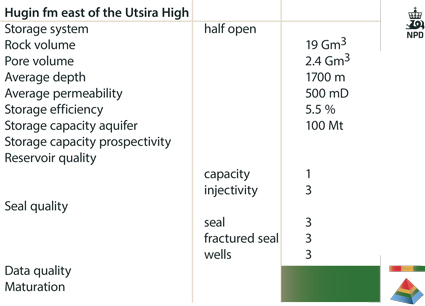
Hugin East Aquifer
One well has been drilled in this aquifer, which has been mapped on 2D seismic data. The reservoir rock is equivalent to the Hugin and Sandnes Formations, and is believed to have good quality. A simplified calculation of theoretical storage capacity was carried out, using a constant net gross value and a porosity trend similar to the Sandnes Formation.
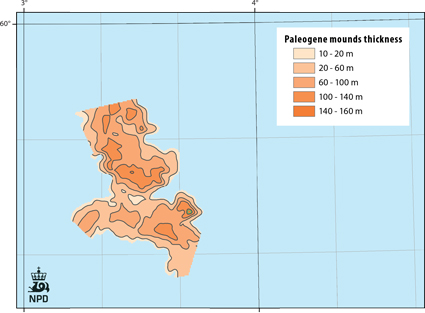
Fig-4-096
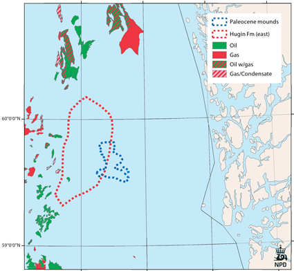
Fig-4-097
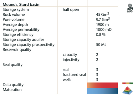
Fig-4-098
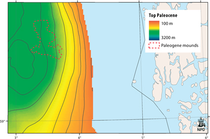
Fig-4-099