The Sognefjord Delta aquifer
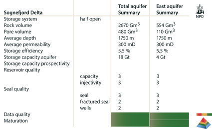
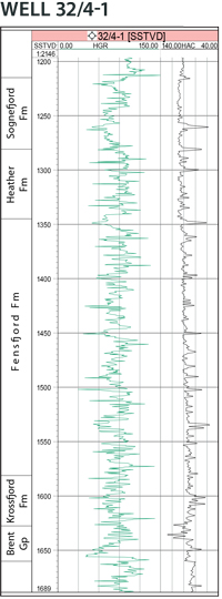
The Sognefjord delta aquifer includes the sandstones belonging to the Viking Group. The Krossfjord, Fensfjord and Sognefjord Formations are partly separated by thin shale units (Heather Formation). Oil and gas production from the giant Troll Field has caused pressure reduction in all the three formations. The three formations are here treated as one aquifer. Influence of the Troll depletion on the aquifers in the older Jurassic formations is less pronounced. These sandy formations will be in communication through local juxtaposition along faults or by local sand-sand contact. In the area east of the Troll Field the sands are in direct contact with each other and constitute a good reservoir.
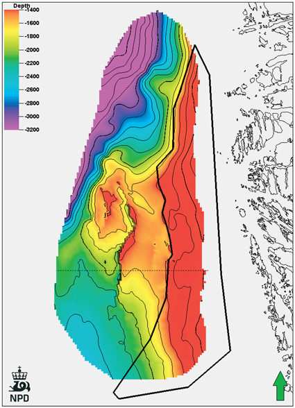
The storage capacity of the western part of the Sognefjord delta has not been included because it forms reservoir rock of the Troll field and other fields north of Troll. The aquifer is treated in the same way as in the main petroleum provinces.
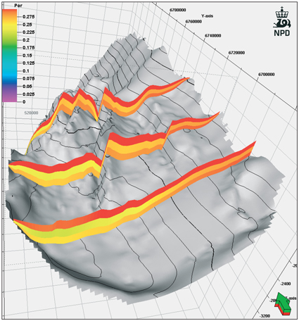
The eastern part of the Sognefjord Delta aquifer (within the black polygon in the figure) is structured by faults in the Øygarden Fault Complex. Two water-filled structural traps have been drilled in this area. This part of the aquifer is considered to be outside the area of large scale hydrocarbon migration, and closed structures may be attractive for CO2 storage.
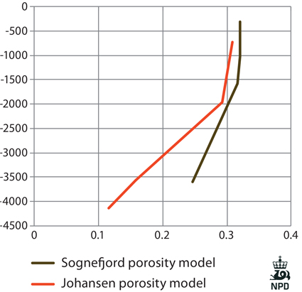
The porosity used for volume calculation is based on depth trends derived from wells in the area.
Several gas accumulations in the west- ern part of the aquifer indicate a good quality seal. The sealing capacity of the fault zones in the Øygarden Fault Complex has to be investigated further. The aquifer subcrops below the Quaternary in the east, and there might be a risk of lateral migration of injected CO2 towards the subcrop area.