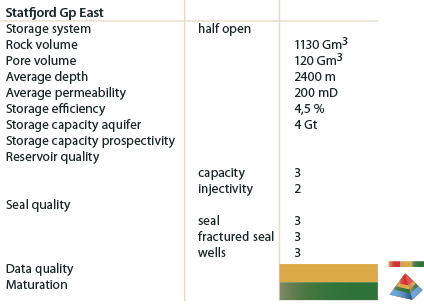
The Statfjord Group aquifer
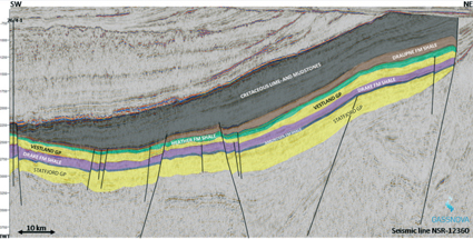
The Statfjord Group contains hydrocarbons in the Viking Graben, Tampen High and north of the Stord Basin. South of the Horda Platform, it is assumed to be mainly water bearing. In the Stord Basin and its surroundings, it is separated from the overlying Jurassic aquifers by the Dunlin Group which is expected to form the seal. Towards the south and towards the Norwegian coast, the Lower Jurassic and large parts of the Middle Jurassic pinch out, and there may be communication between the Statfjord Formation aquifer and the shallower aquifers.
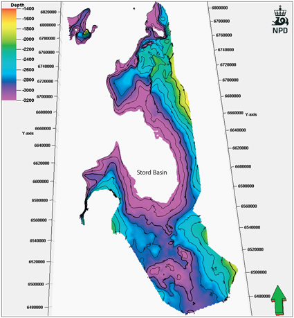
Few wells have been drilled in the Stord Basin area, and neither the formation properties nor its distribution and thickness are well known.
A heterogeneous formation with locally good quality reservoirs, but with limited lateral and vertical continuity can be expected. For the purpose of calculation of theoretical storage capacity, an average net gross of 50 % has been applied to the whole area and a porosity-depth trend similar to the Bryne Formation was applied. This is based on the general geological understanding of the area. In the Stord Basin (fig), parts of the formation are located below 3500 m, and has been excluded from the volume calculation.