2021 programme
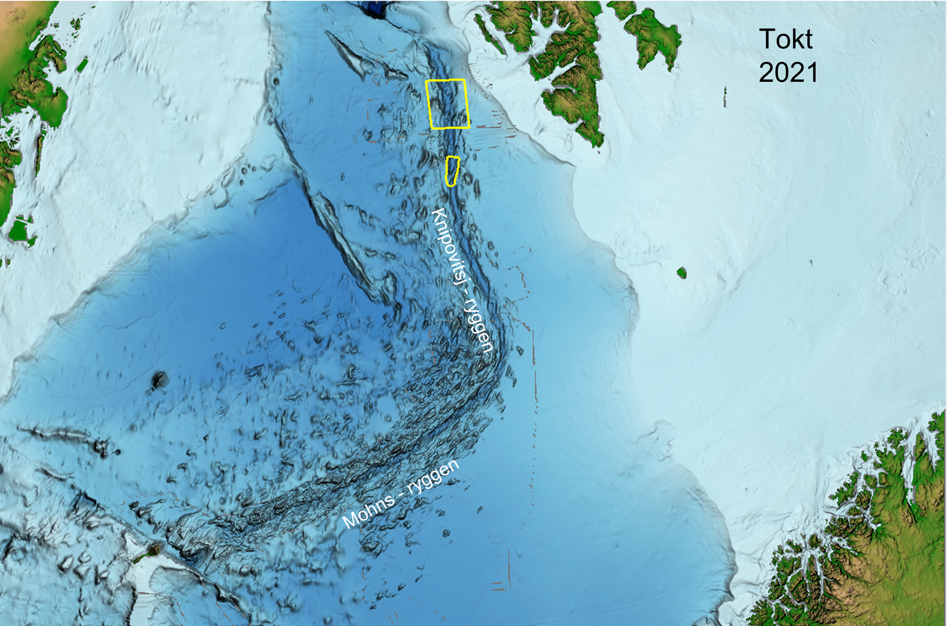
The map provides an overview of the 2021 mapping area. Map: Norwegian Petroleum Directorate.
Detailed mapping was carried out of the seabed associated with northern and central areas of the Knipovich Ridge in the Norwegian Sea.
Contractor
Ocean Infinity MMT
Tool
AUV: 3 x Hugin 6000, 2 of which were in the water at the same time.
Sensors: MBES, SSS, SBP, SAS, Mag, SP, pH/ORP
ROV: Schilling WROV 150
Result
2,200 line kilometres of AUV data, 4 x ROV dives collecting geological samples.
Detailed map
Shows both the mapping area and collected data (in white).
Updated: 11/8/2021